Parcel data & due diligence
Parcel Insights
For buyers, investors, and landowners who want one plain-language read on a parcel’s soil, value, water, flood risk, and market context before they act.
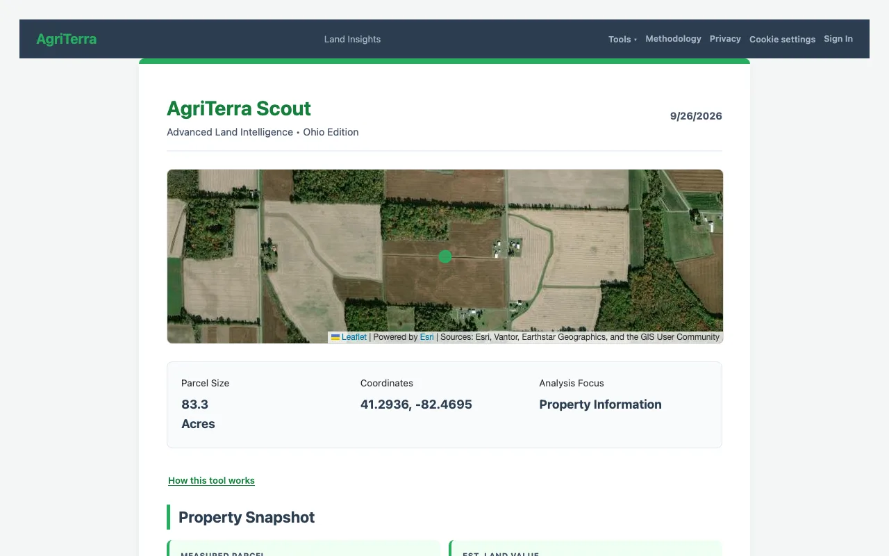
Parcel Insights is a free farmland parcel-data lookup that assembles one plain-language read on a single parcel (property snapshot, soil and productivity, regulatory and tax context, energy and infrastructure, ag value, market context, and risks) from federal datasets and parcel records. It is built for buyers, investors, and landowners doing due diligence who want the picture they’d otherwise stitch together from six government websites in one place, with a source on every figure.
How parcel insights works
- Find the parcel. Search an address or drop a pin. Scout locates the parcel, measures its acreage, and reads its situs and county land-use records where they’re live.
- Scout queries the federal datasets in parallel. Soil, solar, flood, water, wetlands, and value data are pulled for that specific parcel at once, not one slow tab at a time.
- The read is organized into sections. Property snapshot, soil & productivity, regulatory & tax context, energy & infrastructure, agricultural value, market context, and risks & trade-offs, each a plain-language section, not a raw data dump.
- Every figure shows its source. Each number carries the dataset it came from and the date it was read, so you can trust it or check it.
- End on the bottom line. A closing synthesis pulls the sections together into what they mean for a decision, the part a stack of government PDFs never gives you.
What the read is based on
Parcel insights is the widest of the tools because it draws on the full federal-data stack behind AgriTerra, plus live parcel records:
- Soil & productivity: USDA NRCS SSURGO composition, drainage, and capability class.
- Agricultural value & market: USDA NASS per-acre farmland values and county cash-rent benchmarks.
- Energy & infrastructure: NREL PVWatts solar output and a coarse AgriTerra wind resource bucket (read off NREL/WINDExchange 100 m wind maps), plus interconnection-queue activity as a risk signal.
- Water: USGS topo and the nearest USGS water gauge with real-time flow.
- Regulatory context: FEMA flood zones and USFWS National Wetlands Inventory classifications.
- Property records: live parcel boundary, state parcel ID, situs address, and county land-use class where available (Ohio and Indiana today, expanding).
The discipline that makes this a due-diligence tool rather than a marketing page: every figure is checkable. A soil line reads like “Source: USDA SSURGO · accessed 2026-06-03,” and where a dataset doesn’t cover a location the read says “data unavailable” instead of filling the gap. As an illustration of the kind of facts it surfaces: a parcel might show a 0.7-acre FEMA Zone A sliver along a creek and a nearest USGS gauge 3.1 miles off, small things that change an offer and that a soil map alone would never tell you.
A worked example
An investor considering a 95-acre parcel in Tippecanoe County, Indiana. The listing photos look clean and the price per acre seems fair. Parcel insights reads the soils as high-productivity, the NASS value as consistent with the asking price, and the cash-rent benchmark as solid: so far, a good buy.
Then the risk section earns its keep: a corner sits in a FEMA flood zone, a USFWS wetland classification touches the same low ground, and the market-context section notes the county rent trend has flattened. None of it kills the deal, but all of it is ammunition for the offer, and none of it was in the listing. The investor makes a lower, better-supported bid, with the source on every claim if the seller pushes back.
Who it’s for
Buyers and investors running due diligence before an offer, landowners who want to understand what they hold, and heirs assessing inherited ground they’ve never walked. If the parcel is leased and you want to track the lease and benchmark its rent over time, pair this with the farm lease manager; to weigh what the parcel could earn under different uses, use the farmland use optimizer.
Frequently asked questions
- Is parcel insights free?
- Yes. The parcel read, covering soil, value, water, flood, energy, and market context, is free with no account. The optional $89 Decision Report packages the same analysis plus the full flood, wetlands, and program detail into a downloadable PDF.
- Do I need an account?
- No. You can look up a parcel and read every section without signing up. An email is only needed if you want the PDF report sent to you.
- What data sources does it pull from?
- The six federal datasets behind AgriTerra (USDA SSURGO soils, NREL solar, FEMA flood, USGS topo and water, USFWS wetlands, and USDA NASS values) plus live parcel-boundary and situs records where available. Each figure in the read carries its own source line and the date it was read.
- How accurate is the parcel data?
- Every number is pulled from a named public dataset and is checkable against it: the read shows the source and date for each figure rather than presenting a single opaque score. Where a dataset has no entry for a location, it says "data unavailable" instead of guessing.
- Can I look up any parcel, or only my own?
- Any U.S. parcel. It’s built for due diligence, so you can read a parcel you’re considering buying, not just one you own. Pre-loaded boundaries are live in Ohio and Indiana first; elsewhere you outline the parcel on the map.
- Is this a replacement for a title search or survey?
- No. Parcel insights is a data read for decision-making, not a legal record. It points you to the county recorder for ownership and severance questions and to a surveyor for boundaries. It tells you whether a parcel is worth that next step.
Related tools
Lease Manager
Track every lease payment and check the rent against USDA county benchmarks.
farm lease manager →Land-Use Optimizer
Compare every use of your acres, row crops, cash rent, CRP, solar, wind, by modeled return.
farmland use optimizer →Or see all six free farmland tools.
Read the whole parcel before you act.
Look up any U.S. parcel free: soil, value, water, flood, energy, and market context in one sourced read, in under a minute.
Free to start. The full Decision Report is $89.