For rural appraisers
You stake your license on the citation, so the source and the date are on every figure.
When you put a figure in a report, a wrong attribution is a professional liability, not a display issue. Land Scout Pro assembles the descriptive and market layers for a rural parcel from six federal sources, and shows where each number came from and what its vintage is, so the gathering takes minutes instead of an afternoon.
Opens Q1 2027
Land Scout Pro opens Q1 2027. Join the waitlist and we will onboard you personally. Until then, the free parcel read and the $89 Decision Report work today.
Analyze a parcel free
$99 a month at launch, or $990 a year. First seat included, plus $49 a month for each additional seat.
Said plainly, before anything else
This is not an appraisal tool and it does not produce an opinion of value. It gathers and sources the data. The opinion is yours. That boundary is exactly what makes it safe to use in your workflow.
What it assembles, per parcel
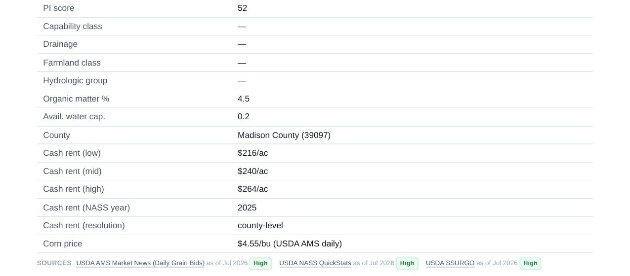
Address in or boundary drawn, and it returns USDA SSURGO soil and productivity, USDA NASS county cash rent, FEMA flood zones, USFWS wetlands, USGS water and drought, NREL solar and state wind suitability, and conservation program eligibility. Every figure carries its agency and its date.
Where it is modeled, it says modeled. The solar and program figures are benchmark ranges, not lease offers, and the product says so on the page rather than in a footnote.
Built around provenance
Per-figure provenance and vintage
The agency and the date on every number, published openly, so a citation is verifiable rather than buried.
CSV and shapefile export
The numbers to CSV and the geometry to a GIS-ready shapefile, into whatever software you already use.
Reports under your own name
White-label output with your name and logo, and folders that group parcels by client.
Part of Land Scout Pro
Questions appraisers ask
- Is this an appraisal tool?
- No. It is not an appraisal and it does not produce an opinion of value. It assembles the descriptive and market layers for a rural parcel so the gathering takes minutes instead of an afternoon. The opinion is yours.
- Can I see where each number comes from?
- Yes. Every figure shows the agency it came from and the date, and modeled figures are labeled as modeled. That provenance is the whole point of the product for appraisers. See how we get our numbers for the full sourcing and vintages.
- Can I export the data and the geometry?
- Yes. Export parcels and scenario numbers to CSV, and parcel geometry to a GIS-ready shapefile, so it goes into the software you already run.
- What does it cost?
- Land Scout Pro opens Q1 2027 at $99 a month, or $990 a year, at launch; the first seat is included, plus $49 a month for each additional seat. Reports carry your own name and logo, and folders group parcels by client.
Run a parcel you have already worked
Put in a parcel you know and check the sourcing against what you have. The most useful thing you can tell us is where we are wrong, and we would rather hear it from an appraiser than from a client.